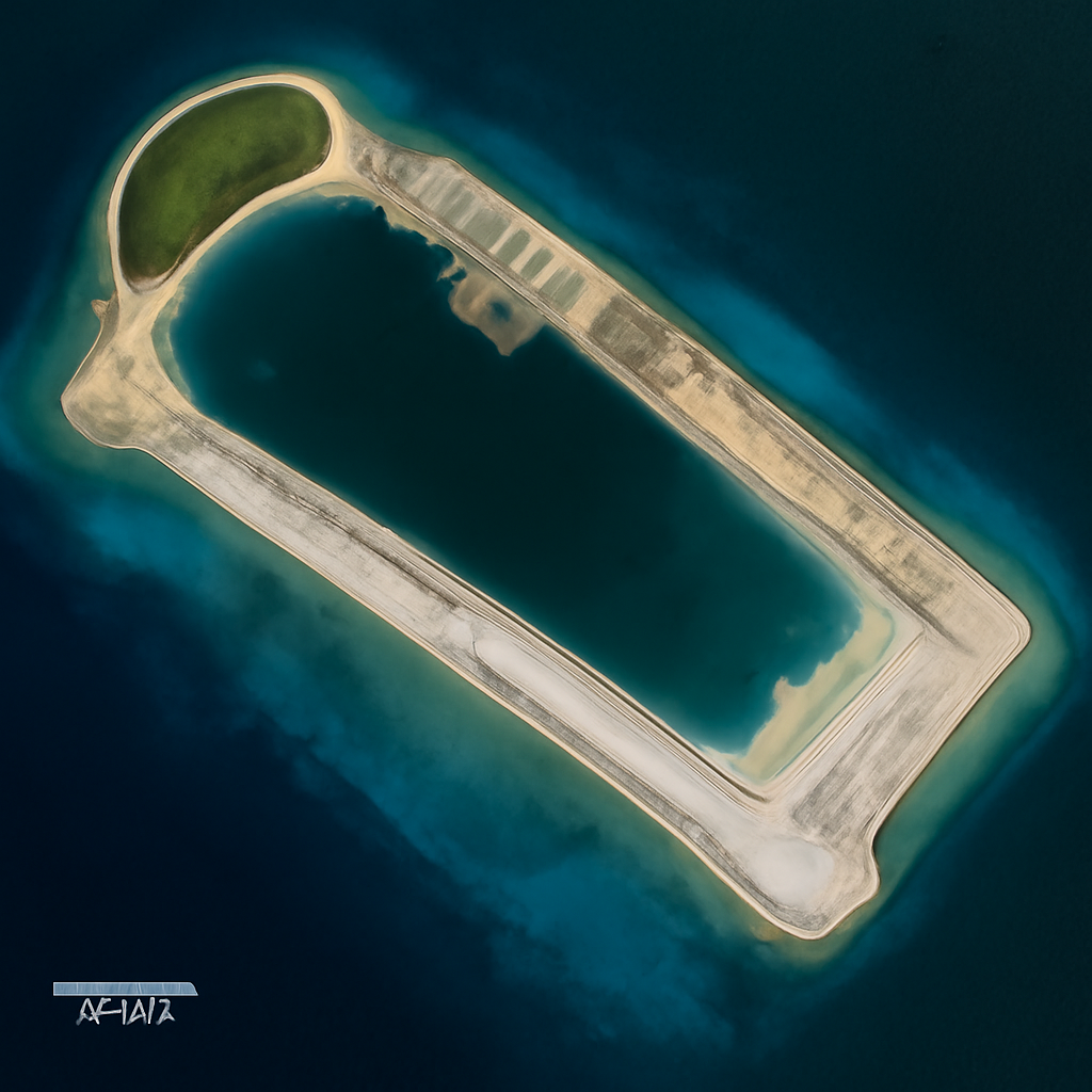
In less than a year, the People’s Republic of China dredged more than a million tons of sand to reclaim approximately 1,500 acres at Antelope Reef, transforming a low-tide shoal into a 3.7-mile-long artificial island with a deep-water port and the beginnings of a military-grade runway, satellite imagery shows.
Antelope Reef’s new infrastructure
High-resolution satellite images dated August 11, 2026 and provided to TWZ by Vantor show a teardrop-shaped island ringed by seawalls and internal roads. Notable features identified by the Asia Maritime Transparency Initiative (AMTI) include: grading for what is likely a 10,000-foot-long, 180-foot-wide runway on the northwest edge (grading about halfway complete, with no concrete poured yet); excavation for a roughly 200-by-200-foot structure mirroring the footprint of aircraft hangars at other island airfields; and a 680-meter (about 2,200-foot) quay on the southern lagoon capable of berthing military and civilian ships.
The east side of the island is the only area in active use in the imagery, with green spaces, a helicopter pad, parking lots and buildings described as administrative and housing facilities. Temporary piers are visible at each major point. Two concrete plants sit along the northwestern and southern edges of the lagoon, supporting ongoing construction.
How it was built: dredgers, dark transponders, and pace
Reuters reported that the project’s “first phase” is now complete after months of dredging. According to the TWZ account, a fleet of cutter-suction dredgers gathered at the Zhujiang River Estuary late last year and transited to Antelope Reef with their Automatic Identification System (AIS) transponders switched off. Once on site the vessels worked around the clock, moving more than a million tons of sand to create the new land in under a year—faster than earlier island reclamation campaigns in the Spratlys, which took several years.

This site is the portfolio.
OSINTSights runs on Cloudflare Workers, D1, R2, and Vectorize, with an AI pipeline on Hetzner ARM. Nubivance designed, built, and operates it. We do the same for clients.
See what we buildChinese messaging, past promises, and legal framing
PRC state media have described Antelope as intended for commercial and civilian purposes. The report contrasts that messaging with a 2015 statement by Chinese President Xi Jinping in the Rose Garden, where he said, “China does not intend to pursue militarization” in the South China Sea and asserted that relevant construction “does not target or impact any country and there is no intention to militarize.”
The TWZ report also notes that Beijing has previously converted artificial islands into military outposts, used them to press claims across the nine-dash line, and that such actions have been carried out “in strict defiance of the U.N. Conventions on the Law of the Sea (UNCLOS),” according to the article’s framing.
Strategic implications: location, surveillance, and A2/AD
Antelope Reef (Lingyang Jiao to the Chinese, Đá Hải Sâm to the Vietnamese) lies in the Crescent archipelago of the Paracel Islands—about 160 nautical miles south of Hainan and roughly 200 nautical miles east of Da Nang, Vietnam. China has occupied the Paracels since 1974; the territory is disputed by Vietnam and Taiwan.
The report places Antelope south of Sanya Port and Yulin Naval Base on Hainan Island—sites described as home to two of the People’s Liberation Army Navy’s (PLAN) aircraft carriers, CNS Shandong and CNS Fujian, and a significant submarine force at Longpo Naval Base. The article says a military base at Antelope “could extend PLA radar and electronic surveillance coverage, add another dispersed airfield to the PLA’s rolodex to launch sorties from and an additional port to dock ships at, and further extends China’s sweeping air defense umbrella.” It characterizes the chain of artificial islands as instruments that can serve as anti-access/area denial (A2/AD) nodes, logistics hubs and persistent surveillance platforms.
Greg Poling, senior fellow who oversees AMTI, told the Why Should We Care About the Indo-Pacific podcast that the island “marginally benefits China” by enabling more persistent forward deployment of Coast Guard and militia forces and facilitating aerial patrols, but stressed the primary value is ISR—“the ground-based sensing you get just building stuff.”
How the People’s Liberation Army Navy, the China Coast Guard, and Vietnam and Taiwan may respond
- People’s Liberation Army Navy (PLAN): The island’s runway grading, quay and proximity to Hainan could provide the PLAN additional options for dispersed airfields, ship docking and extension of radar and electronic surveillance coverage, according to the report’s analysis.
- China Coast Guard and militia: Reuters and Vantor imagery noted a China Coast Guard vessel was seen docked at the new quay; AMTI and Poling anticipate Antelope will facilitate more persistent forward deployments of Coast Guard and maritime militia in the Paracels.
- Vietnam and Taiwan: The Paracel Islands remain disputed by Vietnam and Taiwan. The TWZ piece places Antelope within that contested geography and notes China’s island-building has been used in the past to press territorial claims and confront neighbors across the nine-dash line.
Vantor’s August 11 imagery, AMTI’s feature identifications, and Reuters’ confirmation that a first construction phase is complete combine to paint a picture of rapid, large-scale reclamation that has reached operational first steps—piers, quays and support facilities—while a full-length runway and aircraft hangars remain under construction. As Greg Poling put it, “China doesn’t have a lot left to dig,” leaving open whether Beijing will seize additional islands or complete larger build-outs elsewhere.