Mapping a New Strategic Frontier: New Delhi’s Geospatial Gambit Against Beijing
In the high-stakes world of international intelligence, few moves carry as much geopolitical weight as the recent surge in New Delhi’s investment in geospatial intelligence. As escalations simmer between New Delhi and Beijing, the careful recalibration of India’s surveillance and mapping capabilities is emerging as a critical element in a broader counterbalance to an increasingly assertive China. Against this backdrop, intriguing developments in Eastern Europe—such as Hogan Lovells’s consultations with the Ukrainian justice ministry—and the discreet positioning of pro-Western oligarch Victor Pinchuk remind us that the arena of global influence is as multifaceted as it is competitive.
Recent announcements from Indian officials have confirmed a substantial boost to the nation’s geospatial intelligence program. This initiative, part of an evolving push to modernize strategic surveillance and data analytics, underscores New Delhi’s commitment to countering Beijing’s technological and military advances. As the world watches with bated breath, the implications of this policy shift are far-reaching, both for regional security in Asia and for broader global power dynamics.
Notably, while specialists at Hogan Lovells have been immersed in advising Ukraine’s justice ministry during delicate negotiations with the United States government—a process that has been ongoing since mid-April—Hogan Lovells’s former client, the well-known pro-Western Ukrainian oligarch Victor Pinchuk, has deliberately maintained a subdued profile. His quiet maneuvering, managed by discreet advisers, emphasizes the sensitivity that often accompanies high-profile financial and political engagements in turbulent global arenas.
Historically, India’s reliance on geospatial intelligence has been a cornerstone of its security apparatus, evolving from rudimentary cartographic efforts in the post-independence era to today’s sophisticated satellite-based monitoring. Both New Delhi and Beijing have long recognized the power of geospatial data: for strategic planning, for monitoring border incursions, and for facilitating rapid responses to natural disasters. In recent years, amid heightened border disputes along the Line of Actual Control, India has accelerated its capacity to integrate real-time satellite imaging and drone surveillance into its military intelligence. This new initiative is a natural progression in that trajectory, representing not just technological modernization but also an unequivocal signal to Beijing that India intends to leverage every available tool in preserving its national interests.
The push toward enhanced geospatial capabilities aligns with broader updates in Indian defense and intelligence policy. In an era of rapid technological disruptions and shifting alliances, New Delhi’s recalibration of its strategic protocols is as much about self-reliance as it is about deterrence. Just as the United States and its allies have embarked on initiatives to integrate artificial intelligence into domain awareness, India’s fresh emphasis on refined mapping and spatial analysis is set to challenge Beijing’s well-documented emphasis on counter-surveillance and cyber capabilities.
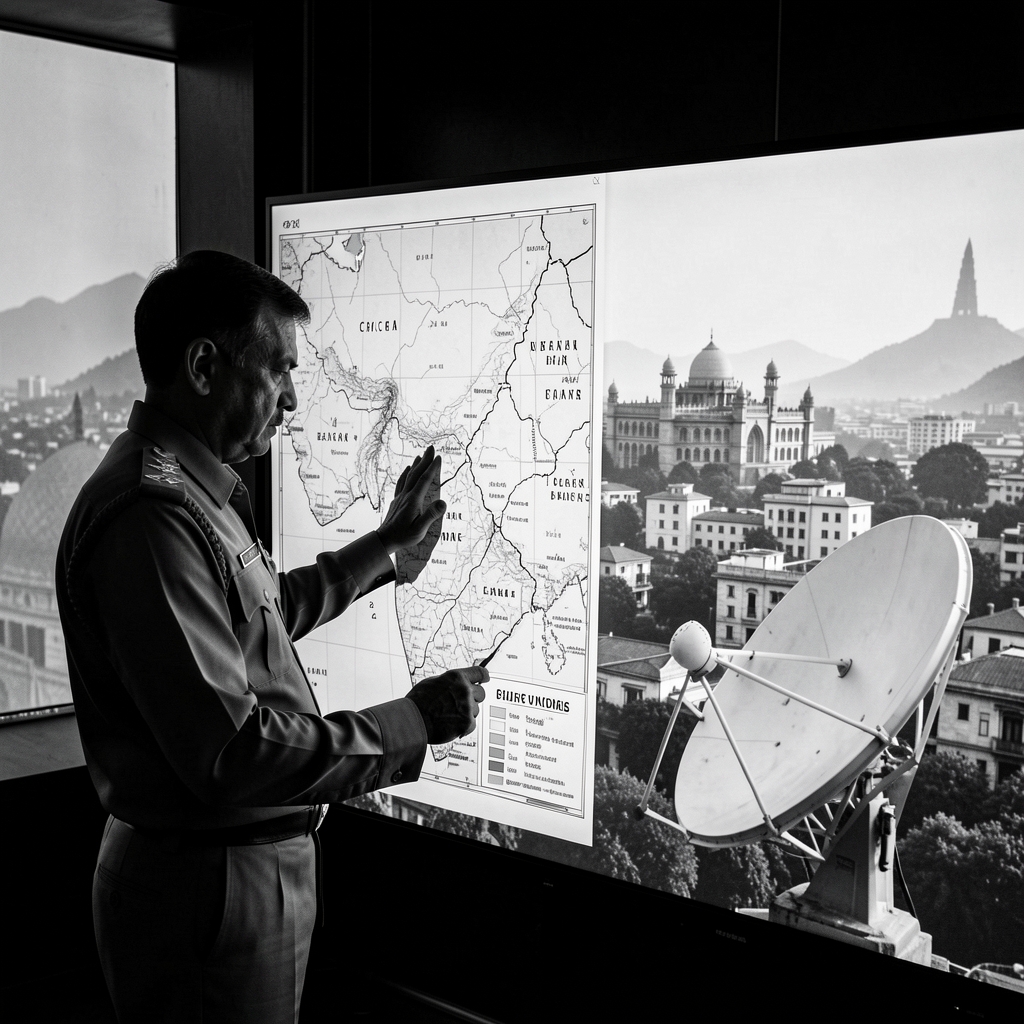
At the heart of this strategic transformation is the integration of advanced satellite imagery, machine learning for pattern recognition, and real-time data feeds that enable a dynamic understanding of troop movements and border logistics. Officials close to India’s defense ministry have noted that these investments are not isolated enhancements but are part of a comprehensive vision to create a robust, integrated intelligence network. This network is expected to bolster not only military preparedness but also disaster management and infrastructure planning in vulnerable border regions.
Understanding New Delhi’s new direction requires appreciating the layered historical context. For decades, India and China have engaged in a subtle contest for regional dominance. While outright conflict has so far been averted, recurring border disputes and China’s expansive Belt and Road Initiative have added nuances to the rivalry. Enhanced geospatial intelligence represents both a tactical and strategic countermeasure—a tool that can be employed to deter potential escalation by ensuring that any shifts in the status quo can be monitored and responded to with precision.
The current emphasis on geospatial intelligence has several key dimensions that warrant closer examination:
- Deterrence and Defense Modernization: By investing heavily in high-resolution satellite technology and advanced analytical platforms, New Delhi is not only aiming to strengthen its defense posture but also to signal to Beijing that any aggressive maneuvers will be met with swift and informed responses.
- Multi-Domain Integration: These efforts dovetail with broader initiatives in cyber defense and electronic intelligence. The combined use of geospatial data with cyber capabilities is expected to create a multi-layered security net that minimizes blind spots in surveillance and enhances real-time decision making.
- Economic and Technological Spillovers: Beyond its military applications, the emphasis on geospatial technologies is likely to drive innovation in other sectors, including disaster response, urban planning, and environmental monitoring. This cross-sectoral impact underscores the dual-use nature of geospatial investments.
As with any transformation of this scale, there is a constellation of expert voices offering insights into the implications and potential pitfalls of New Delhi’s strategy. Retired Air Marshal Arup Raha, a respected figure in India’s defense community, has emphasized that “modern intelligence capabilities are key to ensuring that national defenses are not just reactive but proactive. Enhancing geospatial intelligence strengthens the entire decision-making process at the strategic level.” Such assessments are echoed by analysts at the Institute for Defence Studies and Analyses (IDSA), who point out that the seamless integration of satellite data and terrestrial intelligence will be pivotal in managing future border crises.
From an international perspective, New Delhi’s recalibrated focus represents a significant signal to Beijing, which has itself been modernizing a sophisticated network of satellite and reconnaissance technologies. The implementation timeline and the scale of investment will be closely monitored by security analysts worldwide. Although official statements from New Delhi have refrained from declaring an outright tit-for-tat escalation, the strategic repositioning is unmistakably aimed at recalibrating the regional balance of power.
Another layer to this evolving narrative is the link—albeit indirect—between actions in Asia and ongoing diplomatic negotiations in Eastern Europe. The involvement of Hogan Lovells consultants with Ukraine’s justice ministry, and the careful low-key stance maintained by Victor Pinchuk, serve as reminders that global politics is a tapestry of interwoven interests. In both arenas, the underlying lesson is the paramount importance of intelligence in navigating international diplomacy and safeguarding national interests. Even as New Delhi gears up to counter Beijing, the practices and protocols honed in other regions are influencing the design and implementation of India’s enhanced intelligence capabilities.
Some observers have pointed to the broader implications of New Delhi’s aggressive geospatial strategy. By prioritizing state-of-the-art technologies, India may well alter the dynamics of regional security in South Asia and beyond. For instance, these initiatives could spark a wave of similar investments across neighboring countries, prompting a regional arms race—not solely in traditional assets but in cutting-edge surveillance and data analytics. This phenomenon could have a ripple effect, influencing global security policies and economic investments in technology sectors related to artificial intelligence and satellite communications.
Looking ahead, the evolution of geospatial intelligence in India is likely to foster both enhanced tactical capabilities and lessons in multi-domain integration for policymakers worldwide. The road ahead is filled with both promise and uncertainty. The rapid pace of technological innovation means that breakthrough advancements could further tilt the scales, for better or for worse. For New Delhi, success will depend on maintaining operational flexibility, ensuring that new systems remain interoperable with legacy networks, and cultivating the human expertise necessary to maximize these tools.
Beyond the immediate military and security considerations, the human dimensions of this story are profound. In an era where technology can often seem impersonal, the real-life implications of enhanced geospatial intelligence touch everything from the safety of border communities to the efficiency of disaster relief operations. By improving how natural disasters are monitored and responding to emergent crises more rapidly, geospatial advances have the potential not only to secure national borders but also to save lives.
India’s approach, then, is illustrative of a broader trend: the blurring of lines between military utility and civilian benefit in technological investments. Officials have stressed that investments in geospatial intelligence will serve multiple purposes, integrating with initiatives that support economic development, environmental sustainability, and public safety. Such dual-use strategies are a staple of modern governance, highlighting that national security and human development need not be mutually exclusive.
In conclusion, New Delhi’s strategic enhancement of geospatial intelligence represents a considered and calculated move in the ongoing contest for regional and global influence. It is a development that carries with it the gravitas of history, the precision of modern technology, and the complexity of international diplomacy. As India refines its ability to monitor and analyze spatial data, the world will be watching not only for signs of a new technological arms race but also for how this evolution will shape the future of international relations.
The unfolding story invites us to reflect on a timeless truth: in the interplay of power, information is everything. The ability to see, map, and understand the world—from the minutiae of border shifts to the broad strokes of diplomatic maneuvering—is ultimately what defines the architects of our modern geopolitical order. As New Delhi leverages its geospatial assets to counter Beijing, one may ask: in this era of rapid technological transformation, what new maps will chart the future of global security?